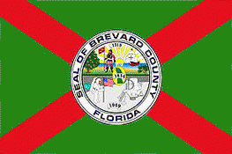
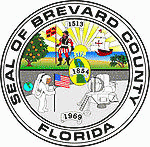
Brevard County (Brevard County)
 |
 |
With an economy strongly influenced by the John F. Kennedy Space Center, Brevard County is also known as the Space Coast. As such, it was designated with the telephone area code 321, as in "3, 2, 1 liftoff". The county is named after Theodore Washington Brevard, an early Florida settler and state comptroller.
A secondary center of county administrative offices was built beginning in 1989 in Viera, Florida, a master planned community in an unincorporated area. The county offices were developed to serve the more populous southern part of the long county.
The first Paleoindians arrived in the area near Brevard county between 12,000 and 10,000 years ago. The Paleoindians were semi-nomadic people who lived in smaller groups. After a few thousand years, a new group of settlers appeared known as "the archaic people." These people were primarily fishermen, as opposed to the hunting and gathering way of life which characterized the Paleoindians. The Windover Archeological Site, discovered in 1982, was found during excavation to have the largest collection of human remains and artifacts of the early Archaic Period (6,000-5,000 BCE), or more than 8,000 years before present. It has been designated as a National Historic Landmark. The Windover pond, which would have been a woody marsh at the time, was used by the Archaic Floridians as a burial ground, with the bodies being wrapped in fabric and submerged in the peaty soil. The pond was used for internments for around a thousand years (circa 8,000 BCE-7,000 BCE).
The Ais and the Jaega were the dominant tribes in the area when it is thought that Ponce De Leon landed on the shores near Melbourne Beach in 1513. There were about 10,000 of these natives in the area. Pedro Menéndez de Avilés gave an early account of the Ais people in 1570 when he was shipwrecked off of Cape Canaveral. He faced hostile natives but through the use of a bluff was able to escape from them and get back to St. Augustine. In 1605, Alvero Mexia was dispatched from St. Augustine to the Indian River area on a diplomatic mission to the Ais Indian Nation. He helped establish a "Period of Friendship" with the Ais Caciques(Chiefs) and made a color map of the area. Throughout the 18th century, the great European powers Spain, Great Britain and France vied for power in Florida. Their interest in the peninsula was more strategic than for building any real settlements. In contrast to today, where living in Florida means comfort and the "good life" to many people, Florida in the 18th century was seen as a hostile place with dangerous fauna such as venomous snakes, alligators and panthers. Death by malaria was a possibility and death at the hands of angry Indians seemed even more likely. After being under Spanish, French, British, and then Spanish rule again, Florida became a United States territory in 1845.
During the 19th century, the state of Florida was constantly changing the names and borders of counties. St. Lucie County was split off from Mosquito County in 1844. St. Lucie County was renamed Brevard County in 1855 after Theodore Washington Brevard, who served as Florida Comptroller from 1854 to 1860. This "Brevard County" contained very little of present-day Brevard County. Most of present-day Brevard north of Melbourne was part of either Volusia or Orange counties. Brevard County in 1856 extended as far west as Polk County and as far south as coastal Dade County. Complicating the discussion of Brevard County in the 19th century is that the boundaries have shifted such that the southernmost parts of present-day Brevard, were originally the northernmost parts. The original county seat was located at Susannah, an early name for present day Fort Pierce. Later the southern part of Brevard split off to form a new county, St. Lucie County in 1905. Gradually, the borders of Brevard County were shifted northward while the county got "pinched" eastward. The portions of Brevard County in present-day Broward and Palm Beach counties were given to Dade County, western areas of the county were given to Polk and Osceola County, and parts of Volusia and Orange Counties were given to Brevard including the eventual county seat of Titusville. Later, the southern portion of the county was cut off to form St. Lucie County, which in turn spawned Martin and Indian River County.
The first concerted development the area occurred with the extension of Henry Flagler's Florida East Coast Railroad into the area. The railroad reached Titusville in 1886 and Melbourne in 1894. With the railroad came increased settlement and the first tourists. The first major land boom began in the 1920s after the end of World War I. People flooded into the state of Florida, both tourists from northern winters and new full-time residents, and land prices soared. The Great Depression temporarily stopped growth in Florida. Before the start of World War II, the largest industries in Brevard were commercial fishing, citrus, and tourism.
In 1940, the government built Naval Air Station Banana River (now Patrick Space Force Base). This military installation was the first of major federal investment in projects to aid the development of Brevard County. The federal government also funded construction of what is now Florida State Road A1A, paralleling the ocean and providing vehicle access to the NAS.
Beginning in the 1930s, Harry T. Moore was a civil rights leader, teacher, and founder of the Brevard County NAACP. After the war he became president of the state NAACP. After the Supreme Court had ruled in 1944 that white primaries were unconstitutional, he conducted voter registration drives and succeeded in registering 31% of black voters in Florida, a higher percentage than in any other southern state. The white establishment resisted, firing both him and his wife Harriette in 1946 from their teaching positions as economic blackmail against them because of their activism. On Christmas night, 1951, a bomb exploded under their home, fatally injuring both of them. The murders were racially motivated and believed committed by members of the Ku Klux Klan. Four separate investigations were conducted, including the first by the FBI in 1951–1952, and the last in 2005 by the state. No one was ever prosecuted.
In the late 1950s, the government opened the Long Range Proving Ground. This later became the Kennedy Space Center. This helped stimulate development in the county; where Brevard had once been considered a "backwoods" area of Florida, it attracted more educated workers and scientists associated with the program. Beginning in the 1960s, new bridges constructed across the waterways were designed as high-rise steel, designed to be high enough to allow passage of boats underneath.
Map - Brevard County (Brevard County)
Map


Country - United_States
 |
 |
| Flag of the United States | |
Indigenous peoples have inhabited the Americas for thousands of years. Beginning in 1607, British colonization led to the establishment of the Thirteen Colonies in what is now the Eastern United States. They quarreled with the British Crown over taxation and political representation, leading to the American Revolution and proceeding Revolutionary War. The United States declared independence on July 4, 1776, becoming the first nation-state founded on Enlightenment principles of unalienable natural rights, consent of the governed, and liberal democracy. The country began expanding across North America, spanning the continent by 1848. Sectional division surrounding slavery in the Southern United States led to the secession of the Confederate States of America, which fought the remaining states of the Union during the American Civil War (1861–1865). With the Union's victory and preservation, slavery was abolished nationally by the Thirteenth Amendment.
Currency / Language
| ISO | Currency | Symbol | Significant figures |
|---|---|---|---|
| USD | United States dollar | $ | 2 |
| ISO | Language |
|---|---|
| EN | English language |
| FR | French language |
| ES | Spanish language |


