Map - Bratislava Region (Bratislava)

Bratislava Region (Bratislava)
The Bratislava Region (Bratislavský kraj,, Pressburger/Bratislavaer Landschaftsverband (until 1919), Pozsonyi kerület) is one of the administrative regions of Slovakia. Its capital is Bratislava. The region was first established in 1923 and its present borders exist from 1996. It is the smallest of the eight regions of Slovakia as well as the most urbanized, most developed and most productive by GDP per capita.

The region is located in the south-western part of Slovakia and has an area of 2,053 km2 and a population of 622,706 (2009). The region is split by the Little Carpathians which start in Bratislava and continue north-eastwards; these mountains separate two lowlands, the Záhorie lowland in the west and the fertile Danubian Lowland in the east, which grows mainly wheat and maize. Major rivers in the region are the Morava River, the Danube and the Little Danube; the last of these, together with the Danube, encircle the Žitný ostrov in the south-east. There are three protected landscape areas in the region: the Little Carpathians, Záhorie and Dunajské luhy. The region borders Trnava Region in the north and east, Győr-Moson-Sopron county in Hungary in the south, Burgenland in Austria in the south-west and Lower Austria in the west.

 
Map - Bratislava Region (Bratislava)
Map
Country - Slovakia
Flag of Slovakia
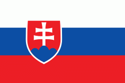
Slovakia ( Slovensko ), officially the Slovak Republic (Slovenská republika ), is a landlocked country in Central Europe. It is bordered by Poland to the north, Ukraine to the east, Hungary to the south, Austria to the southwest, and the Czech Republic to the northwest. Slovakia's mostly mountainous territory spans about 49000 km2, with a population of over 5.4 million. The capital and largest city is Bratislava, while the second largest city is Košice.

The Slavs arrived in the territory of present-day Slovakia in the fifth and sixth centuries. In the seventh century, they played a significant role in the creation of Samo's Empire. In the ninth century, they established the Principality of Nitra, which was later conquered by the Principality of Moravia to establish Great Moravia. In the 10th century, after the dissolution of Great Moravia, the territory was integrated into the Principality of Hungary, which then became the Kingdom of Hungary in 1000. In 1241 and 1242, after the Mongol invasion of Europe, much of the territory was destroyed. The area was recovered largely thanks to Béla IV of Hungary, who also settled Germans, leading them to become an important ethnic group in the area, especially in what are today parts of central and eastern Slovakia.
Currency / Language  
ISO Currency Symbol Significant figures
EUR Euro € 2
Neighbourhood - Country  
  •  Austria 
  •  Czech Republic 
  •  Hungary 
  •  Poland 
  •  Ukraine 
Administrative Subdivision
Country, State, Region,...
City, Village,...
Airport