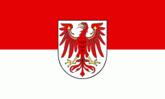
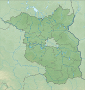
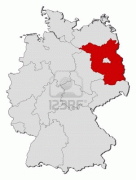
Brandenburg
 |
 |
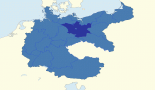
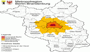
Brandenburg surrounds the national capital and city-state of Berlin, and together they form the Berlin/Brandenburg Metropolitan Region, the third-largest metropolitan area in Germany with a total population of about 6.2 million. There was an unsuccessful attempt to unify both states in 1996 and the states cooperate on many matters to this day.
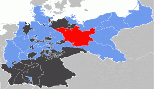
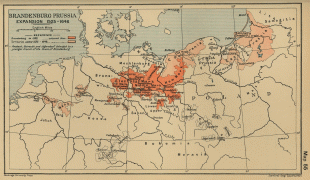
Brandenburg originated in the Northern March in the 900s AD, from areas conquered from the Wends. It later became the Margraviate of Brandenburg, a major principality of the Holy Roman Empire. In the 15th century, it came under the rule of the House of Hohenzollern, which later also became the ruling house of the Duchy of Prussia and established Brandenburg-Prussia, the core of the later Kingdom of Prussia. From 1815 to 1947, Brandenburg was a province of Prussia.
Following the abolition of Prussia after World War II, Brandenburg was established as a state by the Soviet Military Administration in Germany, and became a state of the German Democratic Republic in 1949. In 1952, the state was dissolved and broken up into multiple regional districts. Following German reunification, Brandenburg was re-established in 1990 and became one of the five new states of the Federal Republic of Germany.
The origin of the name Brandenburg is believed to be West Slavic "Brani Boru", meaning "War Forest".
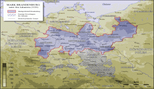
In late medieval and early modern times, Brandenburg was one of seven electoral states of the Holy Roman Empire, and, along with Prussia, formed the original core of the German Empire, the first unified German state. Governed by the Hohenzollern dynasty from 1415, it contained the future German capital Berlin. After 1618 the Margraviate of Brandenburg and the Duchy of Prussia were combined to form Brandenburg-Prussia, which was ruled by the same branch of the House of Hohenzollern. In 1701 the state was elevated as the Kingdom of Prussia. Franconian Nuremberg and Ansbach, Swabian Hohenzollern, the eastern European connections of Berlin, and the status of Brandenburg's ruler as prince-elector together were instrumental in the rise of that state.
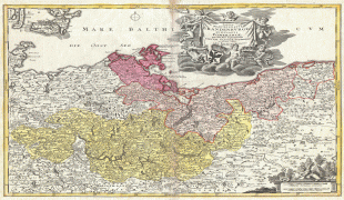
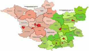
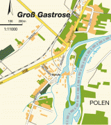
Map - Brandenburg
Map


Country - Germany
 |
 |
| Flag of Germany | |
Various Germanic tribes have inhabited the northern parts of modern Germany since classical antiquity. A region named Germania was documented before AD 100. In 962, the Kingdom of Germany formed the bulk of the Holy Roman Empire. During the 16th century, northern German regions became the centre of the Protestant Reformation. Following the Napoleonic Wars and the dissolution of the Holy Roman Empire in 1806, the German Confederation was formed in 1815.
Currency / Language
| ISO | Currency | Symbol | Significant figures |
|---|---|---|---|
| EUR | Euro | € | 2 |
| ISO | Language |
|---|---|
| DE | German language |


