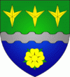
Boulaide
 |
The commune is composed of three villages: Boulaide, Baschleiden, and Surré.
In 1976 the township has erected a monument in honor of the 35th Infantry Division, who liberated the town during World War II.
Boulaide is also a part of the European Road of Freedom. This project was initiated by the Jewish Painter and Sculptor Otto Freundlich, who was killed in a German concentration camp during World War II. Together with his friend Jeanne Kosnick-Kloss he had planned to create two sculpture roads. The first one was supposed to go from North to South and they had called it "The road of human fraternity". The second one was supposed to go from West to East and its name was "the road of human solidarity and the memory of the liberation" At the intersection of the two roads in Auvers-sur-Oise in France they had planned to erect a high tower called "the Lighttower of peace by means of the seven arts". But Otto Freundlich could not carry out his plans and so some 35 years ago, the German artist Leo Kornbrust took over the project and now the plans are to create a road of sculptures from the landing coast in France to Moscow in Russia. In Boulaide this Road of Freedom is present through a group of wooden sculptures, created by the luxemburgish artist Marie Josée Kerschen.
In 2022, the band Grandpa Charlie released the song BOULAIDE! in honour of the commune, which gained much attention around Luxembourg.
Map - Boulaide
Map
Country - Luxembourg
 |
 |
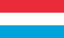
| Flag of Luxembourg | |
With an area of 2,586 km2, Luxembourg is one of the smallest countries in Europe, and the smallest not considered a microstate. In 2022, it had a population of 645,397, which makes it one of the least-populated countries in Europe, albeit with the highest population growth rate; foreigners account for nearly half the population. Luxembourg is a representative democracy headed by a constitutional monarch, Grand Duke Henri, making it the world's only remaining sovereign grand duchy.
Currency / Language
| ISO | Currency | Symbol | Significant figures |
|---|---|---|---|
| EUR | Euro | € | 2 |
| ISO | Language |
|---|---|
| FR | French language |
| DE | German language |
| LB | Luxembourgish language |


