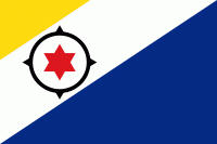
Bonaire
 |
 |
As of 1 January 2019, the island's population totaled 20,104 permanent residents, an increase of about 1,200 since 2015. The island's total land area is 288 km2; it is 38.6 km long from north to south, and ranges from 4.8 – 8 km wide from east to west. A short 800 m west of Bonaire across the sea is the uninhabited islet Klein Bonaire with a total land area of 6 km2. Klein Bonaire has low-growing vegetation including cactus (Papiamento: kadushi), with sparse palm trees near the water and is bordered by white sandy beaches and a fringing reef. The reefs, beaches and on-island reserves located on both Bonaire and Klein Bonaire are under the protection of the Bonaire National Marine Park, and managed by Stichting Nationale Parken Bonaire (STINAPA).
Bonaire was part of the Netherlands Antilles until the country's dissolution in 2010, when the island became a special municipality (officially, a "Caribbean public body") within the country of the Netherlands. It is one of three special municipalities in the Caribbean; the others are Sint Eustatius and Saba. 80% of Bonaire's population are Dutch nationals, and nearly 60% of its residents were born in the former Netherlands Antilles and Aruba.
The name 'Bonaire' is thought to be derived from the Caquetio word Bonay, meaning 'low country'. The early Spanish and Dutch modified its spelling to Bojnaj and also Bonaire. French influence, while present at various times, was never strong enough to make the assumption that the name means 'good air'. According to another theory, the name might be derived from the Spanish phrase "buen aire", which does mean 'good air', as the Spanish were the first Europeans to colonise the island.
Map - Bonaire
Map


Country - Caribbean_Netherlands
 |
 |
Bonaire (including the islet of Klein Bonaire) is one of the Leeward Antilles and is located close to the coast of Venezuela. Sint Eustatius and Saba are in the main Lesser Antilles group and are located south of Sint Maarten and northwest of Saint Kitts and Nevis. The Caribbean Netherlands has a population of 25,157 as of January 2019.
Currency / Language
| ISO | Currency | Symbol | Significant figures |
|---|---|---|---|
| USD | United States dollar | $ | 2 |
| ISO | Language |
|---|---|
| NL | Dutch language |
| EN | English language |