Bomi County (Bomi County)
 |
Bomi is one of 15 counties that comprise the first-level of administrative division in the nation. Tubmanburg serves as the county's capital. The County has four administrive districts.
Bomi is bordered on the northwest by Grand Cape Mount County, on the northeast by Gbarpolu and Bong Counties, on the southeast by Montserrado County and on the southwest by the Atlantic Ocean. As of the 2008 Liberian census, Bomi had a population of 84,119, making it the nation's eleventh most populous county.
From 1822 until the Liberian Declaration of Independence from the American Colonization Society on July 26, 1847 some 3,198 freed slaves and slaves from the Lesser Antilles, who had escaped from their slaveholders or born free left the Caribbean islands and came to Liberia with the help and support from the American Colonization Society and other organizations. The former Caribbean slaves came to Liberia to live a better life, to be free and for self-government. The first batch of slaves who left the Caribbean islands was from Barbados, some 500 to 1,000 freed Caribbean slaves arrived as settlers to Liberia. The second set of settlers who came from the Caribbean islands was 345 from Trinidad and Tobago, followed by 620 from Saint Vincent and the Grenadines, another 350 from Saint Kitts and Nevis, the last two groups of settlers who left the Caribbean islands was 483 from Grenada, and the last group of settlers from Saint Lucia 400 former Caribbean slaves. As job opportunities and development growth increase the former slaves moved through Grand Cape Mount, Bomi, Montserrado County, Margibi County and other regions of Liberia.
Bomi County, formerly known as Bomi Territory, was once part of Montserrado County. The military regime of Samuel Doe established Bomi County in 1983. A legislative act later confirmed the County as being a separate entity. Bomi means “LIGHT” in the Gola language, recognizing the County's status as the first site for iron ore mining in Liberia.
The Liberia Mining Company extracted iron ore in the territory during the 1950s and 1960s. The company closed its operations in 1979.
Map - Bomi County (Bomi County)
Map


Country - Liberia
 |
 |
| Flag of Liberia | |
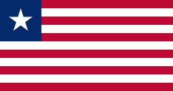
Liberia began in the early 19th century as a project of the American Colonization Society (ACS), which believed black people would face better chances for freedom and prosperity in Africa than in the United States. Between 1822 and the outbreak of the American Civil War in 1861, more than 15,000 freed and free-born African Americans, along with 3,198 Afro-Caribbeans, relocated to Liberia. Gradually developing an Americo-Liberian identity, the settlers carried their culture and tradition with them. Liberia declared independence on July 26, 1847, which the U.S. did not recognize until February 5, 1862.
Currency / Language
| ISO | Currency | Symbol | Significant figures |
|---|---|---|---|
| LRD | Liberian dollar | $ | 2 |
| ISO | Language |
|---|---|
| EN | English language |