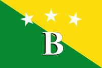
Bocas del Toro Province (Provincia de Bocas del Toro)
 |
Christopher Columbus and his crew first visited the area in 1502. Bocas del Toro borders the Caribbean Sea to the north, Limón Province of Costa Rica to the west, Chiriquí Province to the south, and Ngöbe-Buglé Comarca to the east. The Río Sixaola forms part of the border with Costa Rica. An old railroad bridge spans the river between Guabito and Sixaola, Costa Rica. The bridge is a border crossing used by tourists going between destinations in Bocas del Toro and Costa Rica.
The province contains two national parks, Isla Bastimentos National Marine Park and La Amistad International Park. The Smithsonian Tropical Research Institute operates a research station on Colón Island just northwest of Bocas Town. There are many banana plantations in Bocas del Toro, often called the oro verde, or green gold of Central America.
Christopher Columbus explored the area in 1502 while searching for the passage to the Pacific Ocean. Columbus's original name for the island was Isla del Drago. In colonial times, Bocas del Toro was part of Veraguas. It was originally part of Costa Rica until, in one of many territorial disputes, Colombia took control of it with armed forces. The then government made a reservation called Bocas del Toro in 1834. In 1850, Bocas del Toro became a part of Chiriqui, then was separated from it and became part of Colon. On November 16, 1903, Bocas del Toro was separated from Colon and became its own province. In 1941, Bocas del Toro was divided into two districts, Bocas del Toro and Crimamola. Four years later, it became part of the same division as before. In 1970, Bocas del Toro district became Changuinola, the district of Bastimentos was eliminated, and three new districts were added, making the province what it is today. The districts' areas changed in 1997 when the Ngöbe-Buglé Comarca was created.
The province is the home of the unique Bocas del Toro Creole of English.
Map - Bocas del Toro Province (Provincia de Bocas del Toro)
Map


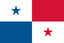
Country - Panama
 |
 |
| Flag of Panama | |
Panama was inhabited by indigenous tribes before Spanish colonists arrived in the 16th century. It broke away from Spain in 1821 and joined the Republic of Gran Colombia, a union of Nueva Granada, Ecuador, and Venezuela. After Gran Colombia dissolved in 1831, Panama and Nueva Granada eventually became the Republic of Colombia. With the backing of the United States, Panama seceded from Colombia in 1903, allowing the construction of the Panama Canal to be completed by the United States Army Corps of Engineers between 1904 and 1914. The 1977 Torrijos–Carter Treaties agreed to transfer the canal from the United States to Panama on December 31, 1999. The surrounding territory was first returned in 1979.
Currency / Language
| ISO | Currency | Symbol | Significant figures |
|---|---|---|---|
| PAB | Panamanian balboa | B/ | 2 |
| USD | United States dollar | $ | 2 |
| ISO | Language |
|---|---|
| EN | English language |
| ES | Spanish language |