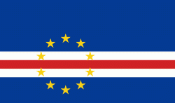
Boa Vista (Concelho da Boa Vista)
The island of Boa Vista is closer to the African continent than all the other islands in Cape Verde, being the easternmost island of all. The distance between Boa Vista and Senegal is only 450 km. The capital of Boa Vista, Sal Rei, is located in the north-western part of the island. Boa Vista is mainly known for its beaches, turtles and traditional music.
Boa Vista is the third largest island after Santo Antão and Santiago, with an area of 631.1 square kilometres. It is situated south of Sal and north of Maio. The island is generally flat, but it has numerous hills like Monte Estância (the highest point of the island at 387 m), Monte Santo António, Rocha Estância, Morro de Areia, Morro Negro, Monte Caçador, Pico Forcado and Monte Vigia.
Boa Vista is famous for its large beaches like Atalanta, Cabral, Chaves, Ervatão, Gatas, Santa Mónica and Varandinha. Its northernmost point is Ponta do Sol; its westernmost point Ponta Varandinha. Its main river is the Ribeira do Rabil, which has the largest basin area of all Cape Verde at 199 km2. Boa Vista is also notable for its desert Deserto de Viana and its dune fields. Boa Vista is surrounded by a number of uninhabited islets, the largest of which is Ilhéu de Sal Rei.
Map - Boa Vista (Concelho da Boa Vista)
Map
Country - Cape_Verde
 |
 |
The Cape Verde archipelago was uninhabited until the 15th century, when Portuguese explorers discovered and colonized the islands, thus establishing the first European settlement in the tropics. Because the Cape Verde islands were located in a convenient location to play a role in the Atlantic slave trade, Cape Verde became economically prosperous during the 16th and 17th centuries, attracting merchants, privateers, and pirates. It declined economically in the 19th century after the suppression of the Atlantic slave trade, and many of its inhabitants emigrated during that period. However, Cape Verde gradually recovered economically by becoming an important commercial center and useful stopover point along major shipping routes. In 1951, Cape Verde was incorporated as an overseas department of Portugal, but its inhabitants continued to campaign for independence, which they achieved in 1975.
Currency / Language
| ISO | Currency | Symbol | Significant figures |
|---|---|---|---|
| CVE | Cape Verde escudo | Esc or $ | 2 |
| ISO | Language |
|---|---|
| PT | Portuguese language |


