Beni Department (El Beni)
 |
 |
With a population of 420,000 (2006 census), Beni is the second least-populated of the nine departments of Bolivia, after Pando.
Although Beni is rich in natural resources, the poverty level of its inhabitants is high, mainly as a result of centuries of exploitation of native populations by European-descended elites. The main economic activities are agriculture, timber, and cattle. In addition, an underground economy linked to illegal narcotics activities flourished in the area during the last decades of the 20th century, with many cocaine laboratories hidden behind the façade of remote cattle ranches.
The Beni region is wide and flat, featuring many large mounds connected by straight earthen causeways, which are believed by researchers to have been built by ancient inhabitants. The earthwork mounds provide raised living areas and enable the growth of trees that could not survive otherwise in the frequently flooded lowland area. In the 21st century, archeologists and anthropologists such as Americans Clark Erickson and William Balée, respectively, believe these earthwork structures are evidence of a large and sophisticated indigenous civilization that flourished for thousands of years before European colonization.
The first European settlers in this area were Spanish Jesuit missionaries during the 18th century, sent to convert the native inhabitants, chiefly in the southern half of the department. The religious origins of many of the Beni's towns can be attested to by the centrality of the local church in most of the communities, and in the very names of the towns: Trinidad, Santa Ana, San Borja, Reyes, etc. Today, the Beni region is the seat of the Roman Catholic Apostolic Vicariate of El Beni.
The importance of cattle ranching is prominent in the regional culture. Cowboys, or "vaqueros", still play an important role in Beni society, comprising a large portion of the working class. Other industries significant to the region include logging, small-scale fishing and hunting, farming, and in recent years, eco-tourism.
Though the Beni lies in the southern reaches of the Amazon Basin, an area renowned for tropical disease, the population has fewer health problems than in the Andes Region, especially those related to malnutrition.
The inhabitants (Benianos) are mostly descendants of Cruceños (people from Santa Cruz) who streamed north following the course of navigable rivers, and native peoples.
The Beniano diet consists largely of rice, bananas, beef, and fish. Some popular dishes include Majao, Masaco, and others, many featuring cured/salted meats.
The majority of the population in Beni is mestizo. The white/mestizo Benianos have traditionally been mistrustful, and often somewhat contemptuous, of Andean culture. They identify as being lighter skinned and of more Spanish ancestry than the Quechua and Aymara-speaking populations of the highlands. Considerable resentment existed against the central government, which allegedly did very little to build roads or integrate the Beni into the economy and political life of Bolivia. These attitudes persisted although Beni residents benefited greatly by the Agrarian Reform instituted following the 1952 Revolution, with many citizens gaining ownership of significant tracts of land. Most of these turned to cattle ranching. The absence of a reliable road linking the department to the main centers of power in the country (owing to the difficult terrain) continued to contribute to the Benianos' perception of isolation, as did a downturn in the cattle industry. As a result, both the white/mestizo population and departmental authorities supported the Santa Cruz-led effort to federalize the country and devolve powers to the departments at the expense of the central government. Considerable social unrest took place in 2007 and 2008, leading some to consider separatism as plausible.
Map - Beni Department (El Beni)
Map
Country - Bolivia
 |
 |
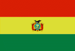
| Flag of Bolivia | |
The sovereign state of Bolivia is a constitutionally unitary state, divided into nine departments. Its geography varies from the peaks of the Andes in the West, to the Eastern Lowlands, situated within the Amazon basin. One-third of the country is within the Andean mountain range. With 1098581 km2 of area, Bolivia is the fifth largest country in South America, after Brazil, Argentina, Peru, and Colombia (and alongside Paraguay, one of the only two landlocked countries in the Americas), the 27th largest in the world, the largest landlocked country in the Southern Hemisphere, and the world's seventh largest landlocked country, after Kazakhstan, Mongolia, Chad, Niger, Mali, and Ethiopia.
Currency / Language
| ISO | Currency | Symbol | Significant figures |
|---|---|---|---|
| BOB | Boliviano | Bs | 2 |
| ISO | Language |
|---|---|
| AY | Aymara language |
| QU | Quechua language |
| ES | Spanish language |


