Map - Bekasi

Bekasi
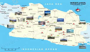
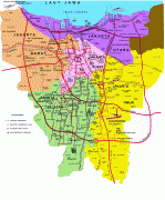
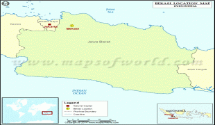
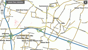
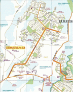
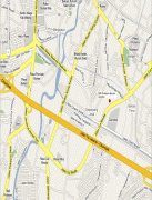
Bekasi is a city in West Java, Indonesia, located on the eastern border of Jakarta. It serves as a commuter city within the Jakarta metropolitan area. According to the 2020 Census by Statistics Indonesia (BPS), Bekasi had 2,543,676 inhabitants. The official estimate for mid 2021 was 2,564,940. It lies within the largest metropolitan area in Indonesia (Jabodetabek). The city is bordered by Bekasi Regency to the north and the east, Bogor Regency and Depok to the south, and East Jakarta to the west.

Bekasi is one of the oldest cities in Indonesia, and has a history of being the capital city of the Kingdom of Tarumanagara. At that time, the name of Bekasi was Dayeuh Sundasembawa or Jayagiri. The earliest evidence of its existence dates from the fifth century according to the Tugu inscription, which describes the name of two rivers that run through the city, i.e. Candrabhaga and Gomati and one of those rivers, i.e. Candrabhaga is the origin of the name Bekasi where the name Candrabhaga evolved into Bhagasasi due to the Sanskrit word candra which means moon evolved into Old Sundanese word 'sasi' which also means moon and then the name Bhagasasi was misspelled as Bhagasi and then Dutch colonial government also misspelled the name Bhagasi as Bacassie and finally it became Bekasi. During the Dutch East Indies period, Bekasi was a part of Batavia residency. As a dormitory city, many middle class satellite areas have been developed in Bekasi, complete with their own shopping malls, schools, hospitals, club houses, water park, and shuttle bus services to central Jakarta. The large number of multinational companies has apparently attracted many expatriates (mainly Japanese and Korean) to settle in Bekasi.

Bekasi has already grown to become one of the centre of growth in Jabodetabek. The city accounts for 2.11% of total national GDP. Recently, many foreigners (mostly Korean, Japanese, and Chinese) have set up their business to take advantage of its dynamism and boost its economy. Bekasi's economy was mainly based on service and manufacturing.

 
Map - Bekasi
Map
Google - Map - Bekasi
Google
Google Earth - Map - Bekasi
Google Earth
Nokia - Map - Bekasi
Nokia
Openstreetmap - Map - Bekasi
Openstreetmap
westjava-map-high.pn...
1932x1623
hakim09.files.wordpr...
PETA%252BJARAK%252BN...
1132x1600
3.bp.blogspot.com
peta-cadangan-air-be...
1123x1587
blog.ub.ac.id
PETA%252BRENCANA%252...
1600x1093
1.bp.blogspot.com
jakarta_map.gif
980x1182
1.bp.blogspot.com
PETA%252BBATAS%252BA...
1293x885
2.bp.blogspot.com
metroBekasi.jpg
791x1024
i297.photobucket.com
bekasi-location-map....
800x800
images.mapsofworld.c...
Map%252BPTC%252Bcopy...
676x895
4.bp.blogspot.com
Bekasi_map_issue.png
1015x578
www.waze.com
map11.png
898x607
avocadojuice.files.w...
shaded-relief-map-of...
850x588
maps.maphill.com
maps-bekasi-to-panda...
800x591
towaltowel.files.wor...
bga21.jpg
608x762
rt01rw06bga2.files.w...
Bekasi-Server-Pulsa....
513x899
3.bp.blogspot.com
satellite-3d-map-of-...
525x850
maps.maphill.com
map+grand+galaxy+cit...
825x532
2.bp.blogspot.com
Peta%252BBekasi1.JPG
703x535
1.bp.blogspot.com
Peta%25252BBekasi1.J...
535x703
1.bp.blogspot.com
CulturalClusterBerli...
420x840
formologix.com
Country - Indonesia
Flag of Indonesia
Indonesia, officially the Republic of Indonesia, is a country in Southeast Asia and Oceania between the Indian and Pacific oceans. It consists of over 17,000 islands, including Sumatra, Java, Sulawesi, and parts of Borneo and New Guinea. Indonesia is the world's largest archipelagic state and the 14th-largest country by area, at 1,904,569 km2. With around 280 million people, Indonesia is the world's fourth-most populous country and the most populous Muslim-majority country. Java, the world's most populous island, is home to more than half of the country's population.

As the world's third largest democracy, Indonesia is a presidential republic with an elected legislature. It has 38 provinces, of which nine have special status. The country's capital, Jakarta, is the world's second-most populous urban area. Indonesia shares land borders with Papua New Guinea, East Timor, and the eastern part of Malaysia, as well as maritime borders with Singapore, Vietnam, Thailand, the Philippines, Australia, Palau, and India. Despite its large population and densely populated regions, Indonesia has vast areas of wilderness that support one of the world's highest level of biodiversity.
Currency / Language  
ISO Currency Symbol Significant figures
IDR Indonesian rupiah Rp 2
Neighbourhood - Country  
  •  Malaysia 
  •  East Timor 
  •  Papua New Guinea