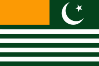
Map - Azad Kashmir (Azad Jammu and Kashmir)

Azad Kashmir (Azad Jammu and Kashmir)
Azad Jammu and Kashmir (آزاد جموں و کشمیر, ; ), abbreviated as AJK and colloquially referred to as simply Azad Kashmir, is a region administered by Pakistan as a nominally self-governing entity and constituting the western portion of the larger Kashmir region, which has been the subject of a dispute between India and Pakistan since 1947.The application of the term "administered" to the various regions of Kashmir and a mention of the Kashmir dispute is supported by the tertiary sources (a) and (b), reflecting due weight in the coverage: (a) (subscription required) Quote: "Kashmir, region of the northwestern Indian subcontinent ... has been the subject of dispute between India and Pakistan since the partition of the Indian subcontinent in 1947. The northern and western portions are administered by Pakistan and comprise two areas: Azad Kashmir, Gilgit- Baltistan, the last being part of a territory called the Northern Areas. Administered by India are the southern and southeastern portions, which constitute the union territory of Jammu and Kashmir but are slated to be split into two union territories. China became active in the eastern area of Kashmir in the 1950s and has controlled the northeastern part of Ladakh (the easternmost portion of the region) since 1962."; (b) C. E Bosworth, University of Manchester Quote: "KASHMIR, kash'mer, the northernmost region of the Indian subcontinent, administered partly by India, partly by Pakistan, and partly by China. The region has been the subject of a bitter dispute between India and Pakistan since they became independent in 1947"; The territory shares a border to the north with Gilgit-Baltistan, together with which it is referred to by the United Nations and other international organizations as "Pakistani-administered Kashmir". Azad Kashmir also shares borders with the Pakistani provinces of Punjab and Khyber Pakhtunkhwa to the south and west, respectively. On its eastern side, Azad Kashmir is separated from the Indian union territory of Jammu and Kashmir (part of Indian-administered Kashmir) by the Line of Control (LoC), which serves as the de facto border between the Indian- and Pakistani-controlled parts of Kashmir. Geographically, the administrative territory of Azad Jammu and Kashmir (which excludes Gilgit-Baltistan) covers a total area of 13297 km2 and has a total population of 4,045,366 as per the 2017 national census.

The territory has a parliamentary form of government modelled after the British Westminster system, with the city of Muzaffarabad serving as its capital. The President of AJK is the constitutional head of state, while the Prime Minister, supported by a Council of Ministers, is the chief executive. The unicameral Azad Kashmir Legislative Assembly elects both the Prime Minister and President. The territory has its own Supreme Court and a High Court, while the Government of Pakistan's Ministry of Kashmir Affairs and Gilgit-Baltistan serves as a link between itself and Azad Jammu and Kashmir's government, although the autonomous territory is not represented in the Parliament of Pakistan.

Northern Azad Kashmir lies in a region that experiences strong vibrations of the earth as a result of the Indian plate underthrusting the Eurasian plate. A major earthquake in 2005 killed at least 100,000 people and left another three million people displaced, causing widespread devastation to the region's infrastructure and economy. Since then, with help from the Government of Pakistan and foreign aid, reconstruction of infrastructure is underway. Azad Kashmir's economy largely depends on agriculture, services, tourism, and remittances sent by members of the British Mirpuri community. Nearly 87% of Azad Kashmiri households own farm property, and the region has the highest rate of school enrollment in Pakistan and a literacy rate of approximately 74%.

Azad Kashmir (Free Kashmir) was the title of a pamphlet issued by the Muslim Conference party at its 13th general session held in 1945 at Poonch. It is believed to have been a response to the National Conference's Naya Kashmir (New Kashmir) programme. Sources state that it was no more than a compilation of various resolutions passed by the party. But its intent seems to have been to declare that the Muslims of Jammu and Kashmir were committed to the Muslim League's struggle for a separate homeland (Pakistan), and that the Muslim Conference was the sole representative organisation of the Muslims of Kashmir. However, the following year, the party passed an "Azad Kashmir resolution" demanding that the maharaja institute a constituent assembly elected on an extended franchise. According to scholar Chitralekha Zutshi, the organisation's declared goal was to achieve responsible government under the aegis of the maharaja without association with either India or Pakistan. The following year, the party workers assembled at the house of Sardar Ibrahim on 19 July 1947 reversed the decision, demanding that the maharaja accede to Pakistan.

Soon afterward, Sardar Ibrahim escaped to Pakistan and led the Poonch rebellion from there, with the assistance of Pakistan's prime minister Liaquat Ali Khan and other officials. Liaquat Ali Khan appointed a committee headed by Mian Iftikharuddin to draft a "declaration of freedom". On 4 October an Azad Kashmir provisional government was declared in Lahore with Ghulam Nabi Gilkar as president under the assumed name "Mr. Anwar" and Sardar Ibrahim as the prime minister. Gilkar travelled to Srinagar and was arrested by the maharaja's government. Pakistani officials subsequently appointed Sardar Ibrahim as the president of the provisional government.

 
Map - Azad Kashmir (Azad Jammu and Kashmir)
Map
Google Earth - Map - Azad Kashmir
Google Earth
Openstreetmap - Map - Azad Kashmir
Openstreetmap
Map - Azad Kashmir - Esri.WorldImagery
Esri.WorldImagery
Map - Azad Kashmir - Esri.WorldStreetMap
Esri.WorldStreetMap
Map - Azad Kashmir - OpenStreetMap.Mapnik
OpenStreetMap.Mapnik
Map - Azad Kashmir - OpenStreetMap.HOT
OpenStreetMap.HOT
Map - Azad Kashmir - OpenTopoMap
OpenTopoMap
Map - Azad Kashmir - CartoDB.Positron
CartoDB.Positron
Map - Azad Kashmir - CartoDB.Voyager
CartoDB.Voyager
Map - Azad Kashmir - OpenMapSurfer.Roads
OpenMapSurfer.Roads
Map - Azad Kashmir - Esri.WorldTopoMap
Esri.WorldTopoMap
Map - Azad Kashmir - Stamen.TonerLite
Stamen.TonerLite
Country - Pakistan
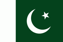
Flag of Pakistan
Pakistan, officially the Islamic Republic of Pakistan , is a country in South Asia. It is the world's fifth-most populous country, with a population of almost 243 million people, and has the world's second-largest Muslim population just behind Indonesia. Pakistan is the 33rd-largest country in the world by area and 2nd largest in South Asia, spanning 881,913 km2. It has a 1,046 km coastline along the Arabian Sea and Gulf of Oman in the south, and is bordered by India to the east, Afghanistan to the west, Iran to the southwest, and China to the northeast. It is separated narrowly from Tajikistan by Afghanistan's Wakhan Corridor in the north, and also shares a maritime border with Oman. Islamabad is the nation's capital, while Karachi is its largest city and financial centre.

Pakistan is the site of several ancient cultures, including the 8,500-year-old Neolithic site of Mehrgarh in Balochistan, the Indus Valley civilisation of the Bronze Age, the most extensive of the civilisations of the Afro-Eurasia, and the ancient Gandhara civilization. The region that comprises the modern state of Pakistan was the realm of multiple empires and dynasties, including the Achaemenid; briefly that of Alexander the Great; the Seleucid, the Maurya, the Kushan, the Gupta; the Umayyad Caliphate in its southern regions, the Hindu Shahis, the Ghaznavids, the Delhi Sultanate, the Mughals, the Durranis, the Omani Empire, the Sikh Empire, British East India Company rule, and most recently, the British Indian Empire from 1858 to 1947.
Currency / Language  
ISO Currency Symbol Significant figures
PKR Pakistani rupee ₨ 2
Neighbourhood - Country  
  •  Afghanistan 
  •  China 
  •  India 
  •  Iran 
Administrative Subdivision
Country, State, Region,...