Auki
Auki is the provincial capital of Malaita Province, Solomon Islands. It is situated on the northern end of Langa Langa Lagoon on the north-west coast of Malaita Island. It is one of the largest provincial towns in Solomon Islands. It was established as the administrative center for Malaita Province in 1909.
There are daily flights between the Solomon's capital of Honiara (on Guadalcanal Island) and Auki. There are also regular shipping services between Honiara and Auki. The area is rich in culture and has become a central hub for many Malaitans who use the area to conduct a majority of trade and business in the province.
The town has electricity and the road is paved to the airport (approx. 11 km). The town has fruit, vegetables and fresh fish sold daily in the newly build market (built by Japanese Aid) located on the waterfront. Tourism is largely underdeveloped in Auki; it is immediately to the north of Langa Langa Lagoon, which provides opportunities for snorkeling, and the villagers provide shell making demonstrations.
The newly elected Member of Parliament in the 2010 elections for Auki-Langalanga constituency is Matthew Cooper Wale who was the former Minister of Education and Human Resources Development in the last government and is currently the Deputy Leader of Opposition. The fifth Anglican Bishop of Malaita, The Right Reverend Sam Sahu is based at the Diocesan office in Auki. He administers Malaita's 42 parishes from Auki.
Correctional Services of Solomon Islands operates the Auki Correctional Centre in Auki.
Map - Auki
Map


Country - Solomon_Islands
 |
 |
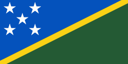
| Flag of the Solomon Islands | |
The islands have been settled since at least some time between 30,000 and 28,800 BCE, with later waves of migrants, notably the Lapita people, mixing and producing the modern indigenous Solomon Islanders population. In 1568, the Spanish navigator Álvaro de Mendaña was the first European to visit them. Though not named by Mendaña, it is believed that the islands were called "the Solomons" by those who later received word of his voyage and mapped his discovery. Mendaña returned decades later, in 1595, and another Spanish expedition, led by Portuguese navigator Pedro Fernandes de Queirós, visited the Solomons in 1606. Britain defined its area of interest in the Solomon Islands archipelago in June 1893, when Captain Gibson, R.N., of HMS Curacoa (1878), declared the southern Solomon Islands a British protectorate. During World War II, the Solomon Islands campaign (1942–1945) saw fierce fighting between the United States, British Commonwealth forces and the Empire of Japan, including the Battle of Guadalcanal.
Currency / Language
| ISO | Currency | Symbol | Significant figures |
|---|---|---|---|
| SBD | Solomon Islands dollar | $ | 2 |
| ISO | Language |
|---|---|
| EN | English language |