Antigua (Antigua Island)
Antigua, also known as Waladli or Wadadli by the native population, is an island in the Lesser Antilles. It is one of the Leeward Islands in the Caribbean region and the most populous island of the country of Antigua and Barbuda. Antigua and Barbuda became an independent state within the Commonwealth of Nations on 1 November 1981.
Antigua means "ancient" in Spanish after an icon in Seville Cathedral, "Santa María de la Antigua" — St. Mary of the Old Cathedral. The name Waladli comes from the indigenous inhabitants and means approximately "our own". The island's perimeter is roughly 87 km and its area 281 km2. Its population was 83,191 (at the 2011 Census). The economy is mainly reliant on tourism, with the agricultural sector serving the domestic market.
Over 22,000 people live in the capital city, St. John's. The capital is situated in the north-west and has a deep harbour which is able to accommodate large cruise ships. Other leading population settlements are All Saints (3,412) and Liberta (2,239), according to the 2001 census.
English Harbour on the south-eastern coast provides one of the largest deep water, protected harbors in the Eastern Caribbean. It is the site of a restored British colonial naval station named "Nelson's Dockyard" after Vice-Admiral The 1st Viscount Nelson. English Harbour and the neighbouring village of Falmouth are yachting and sailing destinations and provisioning centres. During Antigua Sailing Week, at the end of April and beginning of May, an annual regatta brings a number of sailing vessels and sailors to the island to take part in sporting events. Every December for the past 60 years, Antigua has been home to one of the largest charter yacht shows, welcoming super-yachts from around the world.
On 6 September 2017, the Category 5 Hurricane Irma destroyed 90 percent of the buildings on the island of Barbuda and the entire population was evacuated to Antigua.
Map - Antigua (Antigua Island)
Map
Country - Antigua_and_Barbuda
 |
 |
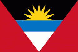
| Flag of Antigua and Barbuda | |
The country consists of two major islands, Antigua and Barbuda, which are approximately 40 km apart, and several smaller islands, including Great Bird, Green, Guiana, Long, Maiden, Prickly Pear, York, and Redonda. The permanent population is approximately 97,120 ( estimates), with 97% residing in Antigua. St. John's, Antigua, is the country's capital, major city, and largest port. Codrington is Barbuda's largest town.
Currency / Language
| ISO | Currency | Symbol | Significant figures |
|---|---|---|---|
| XCD | East Caribbean dollar | $ | 2 |
| ISO | Language |
|---|---|
| EN | English language |


