Map - Ankazoabo Sud

Ankazoabo Sud
 
Map - Ankazoabo Sud
Map
Google Earth - Map - Ankazoabo Sud
Google Earth
Openstreetmap - Map - Ankazoabo Sud
Openstreetmap
Map - Ankazoabo Sud - Esri.WorldImagery
Esri.WorldImagery
Map - Ankazoabo Sud - Esri.WorldStreetMap
Esri.WorldStreetMap
Map - Ankazoabo Sud - OpenStreetMap.Mapnik
OpenStreetMap.Mapnik
Map - Ankazoabo Sud - OpenStreetMap.HOT
OpenStreetMap.HOT
Map - Ankazoabo Sud - OpenTopoMap
OpenTopoMap
Map - Ankazoabo Sud - CartoDB.Positron
CartoDB.Positron
Map - Ankazoabo Sud - CartoDB.Voyager
CartoDB.Voyager
Map - Ankazoabo Sud - OpenMapSurfer.Roads
OpenMapSurfer.Roads
Map - Ankazoabo Sud - Esri.WorldTopoMap
Esri.WorldTopoMap
Map - Ankazoabo Sud - Stamen.TonerLite
Stamen.TonerLite
Country - Madagascar
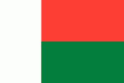
Flag of Madagascar
Madagascar, officially the Republic of Madagascar, is an island country lying off the southeastern coast of Africa. It is the world's fourth largest island, the second-largest island country and the 46th largest country in the world. Its capital and largest city is Antananarivo.

Madagascar consists of an eponymous main island and numerous smaller peripheral islands. Following the prehistoric breakup of the supercontinent Gondwana, Madagascar split from the Indian subcontinent around 90 million years ago, allowing native plants and animals to evolve in relative isolation; consequently, it is a biodiversity hotspot and one of the world's 17 megadiverse countries, with over 90% of wildlife being endemic. The island has a subtropical to tropical maritime climate.
Currency / Language  
ISO Currency Symbol Significant figures
MGA Malagasy ariary Ar 2
Neighbourhood - Country  
Administrative Subdivision
Country, State, Region,...
Language