Map - Alofi

Alofi
Alofi is the capital of the Pacific Ocean island nation of Niue. With a population of 597 in 2017, Alofi has the distinction of being the second smallest national capital city in terms of population (after Ngerulmud, capital of Palau). It consists of the two villages: Alofi North and Alofi South where the government headquarters are located.

In January 2004, Niue was hit by the fierce tropical storm Cyclone Heta which killed two people and did extensive damage to the entire island. Many of Alofi's buildings were destroyed, including the hospital. Government buildings were shifted to a less exposed site 3 km inland from the west coast, named Fonuakula, after the storm. This site is still within the village boundaries of Alofi South.

 
Map - Alofi
Map
Google - Map - Alofi
Google
Google Earth - Map - Alofi
Google Earth
Nokia - Map - Alofi
Nokia
Openstreetmap - Map - Alofi
Openstreetmap
niue09h.gif
2573x3000
www.seafriends.org.n...
20100727K-photo-walk...
1944x2592
coastguardcouple.com
Alofi.jpg
2048x1536
upload.wikimedia.org
Niue_Verwaltungsglie...
1024x1024
upload.wikimedia.org
AlofiMap.png
899x1046
3.bp.blogspot.com
societies.jpg
1012x684
www.starofthewest.co...
Futuna_relief_locati...
969x667
upload.wikimedia.org
Futuna-and-Alofi-bla...
969x667
www.mappery.com
futuna_alofi.jpg
857x687
www.lib.utexas.edu
Futuna_alofi.jpg
857x687
upload.wikimedia.org
alofi-05.jpg
600x733
ds-lands.com
Alofi_location_map.p...
536x600
upload.wikimedia.org
1%25252B004.JPG
640x480
2.bp.blogspot.com
1273682147-alofi-Niu...
636x474
www.yukiba.com
alofi-04.jpg
636x474
ds-lands.com
201010_wallis01.jpg
580x435
icaci.org
201010_wallis04.jpg
580x435
icaci.org
alofi.gif
610x403
www.andrearichichi.c...
alofi.gif
610x403
andrearichichi.com
Alofi.jpg
601x398
www.weather-forecast...
Country - Niue
Flag of Niue
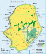
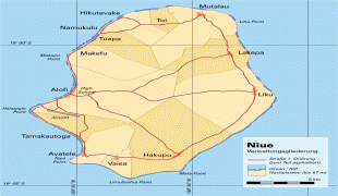
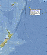
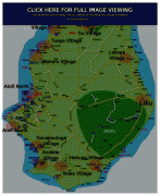
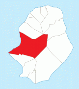
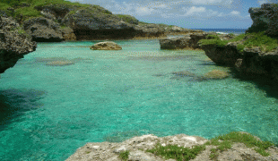
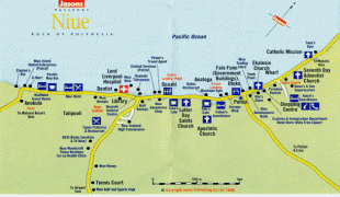
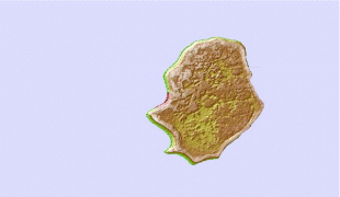
Niue (, ; Niuē) is an island country in the South Pacific Ocean, 2400 km northeast of New Zealand. Niue's land area is about 261 km2 and its population, predominantly Polynesian, was about 1,600 in 2016. Niue is located in a triangle between Tonga, Samoa, and the Cook Islands. It is 604 kilometres northeast of Tonga. The island is commonly referred to as "The Rock", which comes from the traditional name "Rock of Polynesia". Niue is one of the world's largest coral islands. The terrain of the island has two noticeable levels. The higher level is made up of a limestone cliff running along the coast, with a plateau in the centre of the island reaching approximately 60 metres (200 feet) above sea level. The lower level is a coastal terrace approximately 0.5 km (0.3 miles) wide and about 25–27 metres (80–90 feet) high, which slopes down and meets the sea in small cliffs. A coral reef surrounds the island, with the only major break in the reef being in the central western coast, close to the capital, Alofi.

Niue is a self-governing state in free association with New Zealand, and New Zealand conducts most diplomatic relations on its behalf. As part of the Realm of New Zealand, Niueans are citizens of New Zealand and Charles III is Niue's head of state in his capacity as King of New Zealand. Between 90% and 95% of Niuean people live in New Zealand, along with about 70% of the speakers of the Niuean language. Niue is a bilingual country, with 30% of the population speaking both Niuean and English. The percentage of monolingual English-speaking people is only 11%, while 46% are monolingual Niuean speakers.
Currency / Language  
ISO Currency Symbol Significant figures
NZD New Zealand dollar $ 2
ISO Language
EN English language
Neighbourhood - Country