Almaty Province (Almaty Oblysy)
 |
Almaty Region surrounds the city of Almaty. The region borders Kyrgyzstan and Xinjiang in the People's Republic of China. The region also touches three other regions of Kazakhstan: Jambyl Region to the west, Karaganda Region to the northwest, and East Kazakhstan Region to the north. Almaty Region has an area of 224,000 square kilometres.
Much of the northwestern border of the region runs along Lake Balkhash, whose main affluent, the Ili River, is the most significant river of the region. In the region's northeast, it shares the four lakes of the Alakol Depression (Lakes Alakol, Sasykkol, Koshkarkol, and Zhalanashkol) with East Kazakhstan Region. Other lakes within the region include Bartogay Lake and Kapshagay lakes, Lake Issyk, Kaindy and Kolsai lakes.
The Trans-Ili Alatau branch of the Tian Shan Mountains extends from China and Kyrgyzstan into Almaty Region, along its southern border with Kyrgyzstan. Farther to the northeast, the Dzungarian Alatau runs along the region's border with China. The Charyn Canyon is one of the region's famous scenic spots.
Map - Almaty Province (Almaty Oblysy)
Map
Country - Kazakhstan
 |
 |
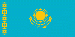
| Flag of Kazakhstan | |
The country dominates Central Asia economically and politically, generating 60 percent of the region's GDP, primarily through its oil and gas industry; it also has vast mineral resources. Officially, it is a democratic, secular, unitary, constitutional republic with a diverse cultural heritage, and has the highest Human Development Index ranking in the region. Kazakhstan is a member state of the United Nations, World Trade Organization, Commonwealth of Independent States, Shanghai Cooperation Organisation, Eurasian Economic Union, Collective Security Treaty Organization, Organization for Security and Cooperation in Europe, Organization of Islamic Cooperation, Organization of Turkic States, and International Organization of Turkic Culture.
Currency / Language
| ISO | Currency | Symbol | Significant figures |
|---|---|---|---|
| KZT | Kazakhstani tenge | ₸ | 2 |
| ISO | Language |
|---|---|
| KK | Kazakh language |
| RU | Russian language |


