Albrechtice nad Orlicí (Albrechtice nad Orlicí)
Albrechtice nad Orlicí (Albrechtsdorf an der Adler) is a municipality and village in Rychnov nad Kněžnou District in the Hradec Králové Region of the Czech Republic. It has about 1,000 inhabitants.
Albrechtice nad Orlicí is located about 17 km southeast of Hradec Králové. It lies in the Orlice Table. It is situated on the left bank of the Orlice River.
Albrechtice nad Orlicí is located about 17 km southeast of Hradec Králové. It lies in the Orlice Table. It is situated on the left bank of the Orlice River.
Map - Albrechtice nad Orlicí (Albrechtice nad Orlicí)
Map


Country - Czech_Republic
 |
 |
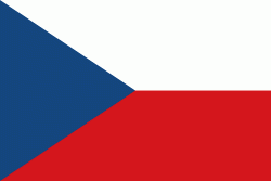
| Flag of the Czech Republic | |
The Duchy of Bohemia was founded in the late 9th century under Great Moravia. It was formally recognized as an Imperial State of the Holy Roman Empire in 1002 and became a kingdom in 1198. Following the Battle of Mohács in 1526, the whole Crown of Bohemia was gradually integrated into the Habsburg monarchy. The Protestant Bohemian Revolt led to the Thirty Years' War. After the Battle of White Mountain, the Habsburgs consolidated their rule. With the dissolution of the Holy Empire in 1806, the Crown lands became part of the Austrian Empire.
Currency / Language
| ISO | Currency | Symbol | Significant figures |
|---|---|---|---|
| CZK | Czech koruna | KÄ | 2 |
| ISO | Language |
|---|---|
| CS | Czech language |
| SK | Slovak language |