Al Batinah Region (Al Batinah South Governorate)
Al-Bāţinah (ٱلْبَاطِنَة) was one of the regions (Mintaqat) of Oman. On 28 October 2011, Al-Batinah Region was split into Al Batinah North Governorate and Al Batinah South Governorate.
The region occupied an important location on the coast of Gulf of Oman. It lay between Khatmat Malahah in the north and Ras al-Hamra in the south, and confined between Al Hajar Mountains in the west and the Gulf of Oman in the east. Most of Oman's population were in that region, because of the green plains between the Hajar Mountains and the sea.
Al Batinah Region contained the largest number of provinces (wilayat), numbering twelve: Sohar, Ar Rustaq, Shinas, Liwa, Saham, Al-Khaburah, Suwayq, Nakhal, Wadi Al Maawil, Al Awabi, Al-Musannah, Barka. Suwayq is considered as the biggest wilayah in the Batinah region.
Sohar was the regional capital. It is a populous city with a corniche, fish souq and numerous mosques.
Map - Al Batinah Region (Al Batinah South Governorate)
Map
Country - Oman
 |
 |
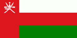
| Flag of Oman | |
From the 17th century, the Omani Sultanate was an empire, vying with the Portuguese and British empires for influence in the Persian Gulf and Indian Ocean. At its peak in the 19th century, Omani influence and control extended across the Strait of Hormuz to Iran and Pakistan, and as far south as Zanzibar. When its power declined in the 20th century, the sultanate came under the influence of the United Kingdom. For over 300 years, the relations built between the two empires were based on mutual benefit. The UK recognized Oman's geographical importance as a trading hub that secured their trading lanes in the Persian Gulf and Indian Ocean and protected their empire in the Indian sub-continent. Historically, Muscat was the principal trading port of the Persian Gulf region.
Currency / Language
| ISO | Currency | Symbol | Significant figures |
|---|---|---|---|
| OMR | Omani rial | رع. | 3 |
| ISO | Language |
|---|---|
| AR | Arabic language |
| EN | English language |
| UR | Urdu |


