Ajloun
The Ajlun Governorate has a population of over 176,080 widespread in 27 villages and towns over an area of about 420 km². The population is mainly composed of the following Muslim tribe: AlQudah is the main family.Christian tribes in Ajloun. Although Christians are a minority in the overall governorate, they form about more than half of the population in Ajloun city; most Christians reside in Ajloun city along with Muslims of the Al-Smadi tribe. Other tribes are distributed in the other districts of the governorate. Ajloun Governorate has four seats in the national parliament, one of which is dedicated for the Christian minority.
There are five districts in the Greater Ajloun Municipality:
Map - Ajloun
Map


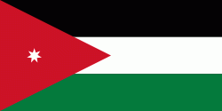
Country - Jordan
 |
 |
| Flag of Jordan | |
Modern-day Jordan has been inhabited by humans since the Paleolithic period. Three stable kingdoms emerged there at the end of the Bronze Age: Ammon, Moab and Edom. In the third century BC, the Arab Nabataeans established their Kingdom with Petra as the capital. Later rulers of the Transjordan region include the Assyrian, Babylonian, Roman, Byzantine, Rashidun, Umayyad, Abbasid, and the Ottoman empires. After the Great Arab Revolt against the Ottomans in 1916 during World War I, the Greater Syria region was partitioned by Britain and France. The Emirate of Transjordan was established in 1921 by the Hashemite, then Emir, Abdullah I, and the emirate became a British protectorate. In 1946, Jordan gained independence and became officially known in Arabic as the Hashemite Kingdom of Jordan. The country captured the West Bank during the 1948 Arab–Israeli War and annexed it until it was lost to Israel in 1967. Jordan renounced its claim to the territory in 1988, and became the second Arab state to sign a peace treaty with Israel in 1994.
Currency / Language
| ISO | Currency | Symbol | Significant figures |
|---|---|---|---|
| JOD | Jordanian dinar | دا | 3 |
| ISO | Language |
|---|---|
| AR | Arabic language |
| EN | English language |