Ailinglaplap Atoll (Ailinglaplap Atoll)
Ailinglaplap or Ailinglapalap (Marshallese: Aelōn̄ļapļap, ) is a coral atoll of 56 islands in the Pacific Ocean, and forms a legislative district of the Ralik Chain in the Marshall Islands. It is located 152 km northwest of Jaluit Atoll. Its total land area is only 14.7 km2, but it encloses a lagoon of 750 km2. The economy of the atoll is dominated by coconut plantations. The population of the atoll was 1,729 in 2011. Jabat Island is located off the coast of Ailinglaplap Atoll. The former president of the Marshall Islands, Kessai Note, was born on Jeh Island, Ailinglaplap Atoll.
"Ailinglaplap" translates as "greatest atoll" (aelōn̄ (atoll) + ļapļap (superlative suffix)), because the greatest legends of the Marshallese people were created there. The four major population centers on Ailinglaplap Atoll are the settlements of Wotja, at the westernmost end of the atoll, Jih in the northeast, and Airek and Bigatjelang in the south.
Captain Thomas Dennet of the British vessel Britannia sighted the atoll in 1797 on route from Australia to China and named it Lambert Island. The British merchant vessel Rolla sighted several islands in the Ratak and Ralik Chains. On 6 November 1803 she sighted islands at 7.2°N, 166.66667°W, which was possibly Ailinglaplap Atoll. The next day six canoes of friendly natives came off. Rolla had transported convicts from Britain to New South Wales and was on her way to Canton to find a cargo to take back to Britain.
In 1884, the Empire of Germany claimed Ailinglaplap Atoll along with the rest of the Marshall Islands. A number of European trading stations were established on the islands to Ailingkaplap as part of the copra trade. After World War I, the island came under the South Seas Mandate of the Empire of Japan. The base became part of the vast US Naval Base Marshall Islands. Following the end of World War II, it came under the control of the United States as part of the Trust Territory of the Pacific Islands until the independence of the Marshall Islands in 1986.
There are currently 4 Iroijlaplap (or paramount chief) of Ailinglaplap.
Map - Ailinglaplap Atoll (Ailinglaplap Atoll)
Map


Country - Marshall_Islands
 |
 |
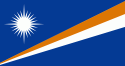
| Flag of the Marshall Islands | |
The country's population of 42,050 people (at the 2021 World Bank Census ) is spread out over five islands and 29 coral atolls, comprising 1,156 individual islands and islets. The capital and largest city is Majuro. It has the largest portion of its territory composed of water of any sovereign state, at 97.87%. The islands share maritime boundaries with Wake Island to the north, Kiribati to the southeast, Nauru to the south, and the Federated States of Micronesia to the west. About 52.3% of Marshall Islanders (27,797 at the 2011 Census) live on Majuro. In 2016, 73.3% of the population were defined as being "urban". The UN also indicates a population density of 295 PD/km2, and its projected 2020 population is 59,190.
Currency / Language
| ISO | Currency | Symbol | Significant figures |
|---|---|---|---|
| USD | United States dollar | $ | 2 |
| ISO | Language |
|---|---|
| EN | English language |
| MH | Marshallese language |