Agogo (Agogo)
Agogo is a town in the Asante Akim North Municipal District of the Ashanti Region of Ghana. Agogo is approximately 80 kilometers east of Kumasi, the capital of the Ashanti Region, and had a population of 28,271 in the 2000 census. Computer projections estimate that the 2007 population was 32,859.
Around the year 1500, the people of the Aduana clan in Asantemanso, who were originally from Esumegya, dispersed to settle in different parts of the country. One group settled at Nyanawase under Ansa Sasraku, but moved again after a series of wars with the Ashantis and the Gas. In the end they settled in Akwamu.
In or around the year 1600, three chiefs of the Aduana clan: Ofori Krobon of Agogo, Ntori Nimpa of Kwaman, and Effa Kai of Kumawu left Akwamu to join forces under the command of Ofori Krobon of Agogo with the intention of fighting and defeating Ataara Finam. He was the supreme ruler of the Afram plains at that time. This war lasted for almost three years. All the lands controlled by the vanquished Ataara Finam were annexed to the three stools who were independent of each other. Because of this annexation, the three stools - Agogo, Kumawu and Kwaman - all controlled some of the most extensive land possessions in the Ashanti Union. Their lands extended to Akwamu, the Volta Region, Brong Ahafo and to parts of the Northern Region.
Meanwhile, the people of Agogo settled in Santenso, which is where the three-year war with Ataara Finam came to an end. Like all other Asante states, the people of Agogo had remained an independent entity until the need to form a union of states became apparent. The people of Agogo did directly participate in the Denkyira war in 1698, which concluded in the liberation of Asanteman from Denkyira under Ashanti King Asantehene Osei Tutu I. However, they did contribute men and materials to support the Ashanti forces.
Map - Agogo (Agogo)
Map
Country - Ghana
 |
 |
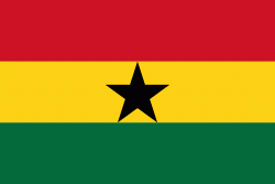
| Flag of Ghana | |
The Bono state existed in the area that is modern day Ghana during the 11th century. Kingdoms and empires such as Kingdom of Dagbon in the north and the Ashanti Empire in the south emerged over the centuries. Beginning in the 15th century, the Portuguese Empire, followed by other European powers, contested the area for trading rights, until the British ultimately established control of the coast by the 19th century. Following over a century of colonial resistance, the current borders of the country took shape, encompassing 4 separate British colonial territories: Gold Coast, Ashanti, the Northern Territories, and British Togoland. These were unified as an independent dominion within the Commonwealth of Nations. On 6th March 1957, Ghana became the first country in Sub-Saharan Africa to achieve sovereignty. Ghana subsequently became influential in decolonisation efforts and the Pan-African movement.
Currency / Language
| ISO | Currency | Symbol | Significant figures |
|---|---|---|---|
| GHS | Ghanaian cedi | ₵ | 2 |
| ISO | Language |
|---|---|
| AK | Akan language |
| EN | English language |
| EE | Ewe language |
| TW | Twi |


