Aghjabadi Rayon (Aghjabadi Rayon)
Aghjabadi District was established on 8 August 1930. It was abolished and attached to the Agdam District in 1963. Two years later, it was re-established as an independent district.
"Aghjabadi" means "large settlement" ("aghja" – large, "badi" – residence, settlement) in Azerbaijani. The ancient monuments discovered on the territory of Aghjabadi rayon attest to human habitation dating to the Eneolithic, Bronze Age periods. There are also remnants of the Middle Ages found at the Kamiltepe, Nargiztepe, Garakober, Yantepe, Galatepe and Gavur archaeological sites.
Among the remains of the Eneolithic Age are the cemetery and the residence site called "Kichik" on the kurgan barrow in the village of Boyat, ruins of an ancient settlement Yastitepe in the village of Hindarx, residence sites Akhanglitepe, Keshaltitepe, Jafargulutepe, Husulutepe in Hacılar village, ruins of Kamiltepe and Shahtepe settlements in Yeni Qaradolaq village, the archaeological sites of Sutepe, Agtepe and Janavartepe in Taynaq village, Mirvaritepe I and II, Abiltepe I and II, Muhammedtepe in the İmamqulubəyli municipality.
Archeological sites dating back to the Bronze Age include Kultepe, Saribashtepe, Uchtepe, Shahtepe in Agjabadi, Gyshaltitepe, Qebristanliqtepe, Galatepe in Boyat village, Elashantepe in Gələbədin, kurgan barrows Gushtepe, Huseinbey and Gazantepe in Hindarx village, and Sumuklu-tepe in Cəfərbəyli village.
Ancient living settlements have been discovered in Təzəkənd (5th-2nd millennia BC), Arazbar (1st millennium), Qiyaməddinli (1st millennium) and Hüsülü villages, as well as the Sangartepe and Toratepe living settlements found in Sarıcalı and Şənlik villages.
Several historical monuments, one school, the Regional Centre of Culture and a library were destroyed and burned by Armenian forces during the Karabakh War in Yuxarı Qiyaməddinli village.
Map - Aghjabadi Rayon (Aghjabadi Rayon)
Map
Country - Azerbaijan
 |
 |
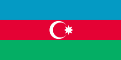
| Flag of Azerbaijan | |
The Azerbaijan Democratic Republic proclaimed its independence from the Transcaucasian Democratic Federative Republic in 1918 and became the first secular democratic Muslim-majority state. In 1920, the country was incorporated into the Soviet Union as the Azerbaijan SSR. The modern Republic of Azerbaijan proclaimed its independence on 30 August 1991, shortly before the dissolution of the Soviet Union in the same year. In September 1991, the ethnic Armenian majority of the Nagorno-Karabakh region formed the self-proclaimed Republic of Artsakh. The region and seven surrounding districts are internationally recognized as part of Azerbaijan pending a solution to the status of the Nagorno-Karabakh through negotiations facilitated by the OSCE, although became de facto independent with the end of the First Nagorno-Karabakh War in 1994. Following the Second Nagorno-Karabakh War in 2020, the seven districts and parts of Nagorno-Karabakh were returned to Azerbaijani control.
Currency / Language
| ISO | Currency | Symbol | Significant figures |
|---|---|---|---|
| AZN | Azerbaijani manat | ₼ | 2 |
| ISO | Language |
|---|---|
| HY | Armenian language |
| AZ | Azerbaijani language |
| RU | Russian language |


