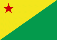
Acre (Acre)
 |
 |
Its capital and largest city is Rio Branco. Other important places include Cruzeiro do Sul, Sena Madureira, Tarauacá and Feijó.
Intense extractive activity in the rubber industry, which reached its height in the early 20th century, attracted Brazilians from many regions to the state. From the mixture of sulista, southeastern Brazil, nordestino, and indigenous traditions arose a diverse cuisine. It combines sun-dried meat (carne-de-sol) with pirarucu, a typical fish of the region. Such dishes are seasoned with tucupi, a sauce made from manioc.
Fluvial transport, concentrated on the Juruá and Moa rivers, in the western part of the state, and the Tarauacá and Envira rivers in the northwest, is the principal form of transportation, especially between November and June. Heavy seasonal rains frequently make the BR-364 impassable in those months; it usually connects Rio Branco to Cruzeiro do Sul.
The name, which was given to the territory in 1904, is derived from one of the local rivers, and to the state in 1962, perhaps originates from the Tupi word a'kir ü "green river", or from the form a'kir, of the Tupi word ker, "to sleep, to rest". It is believed more likely to be derived from Aquiri, a transliteration by European explorers of the term Umákürü, or Uakiry, from the Ipurinã dialect. Another hypothesis is that Acquiri derives from Yasi'ri, or Ysi'ri, meaning "flowing or swift water".
According to one account, agriculturist João Gabriel de Carvalho Melo wrote during an 1878 trip on the Purús River to merchant Viscount of Santo Elias (from Pará), asking him for goods to be sent to the "mouth of the Aquiri River". In Belém, the local merchant or his employees either misinterpreted Gabriel's handwriting, or he spelled the name wrong: the goods and invoice which Gabriel received were marked as having been sent to the Acre River.
Acre possesses some nicknames: the End of Brazil, The Rubber Tree State, the Latex State (from when it was a center of rubber production) and the Western End.
The native inhabitants of Acre are called acrianos, in the singular acriano. Until the entry according to the Orthographic Agreement of 1990, the correct spelling was acreano in the singular and in the plural acreanos. In 2009, with the new orthographic agreement, the change generated controversy between the Academy of Letters of Acre (Academia Acreana de Letras) and the Brazilian Academy of Letters (Academia Brasileira de Letras). The latter said that the change would mean the denial of the state's historical and cultural roots, by changing the last letter of the toponym from "E" to "I".
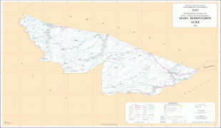
Map - Acre (Acre)
Map


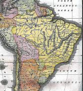
Country - Brazil


Currency / Language
| ISO | Currency | Symbol | Significant figures |
|---|---|---|---|
| BRL | Brazilian real | R$ | 2 |
| ISO | Language |
|---|---|
| EN | English language |
| FR | French language |
| PT | Portuguese language |
| ES | Spanish language |


