Abutig (Abū Tīj)
Abu Tig (أبو تيج; Ⲧⲁⲡⲟⲑⲏⲕⲏ Tapothēkē ) is a city in the Asyut Governorate of Egypt. Located on the west bank of the Nile, it has a population of 70,969 inhabitants (2006).
Abu Tig is the third largest city in Asyut Governorate in Egypt after Asyut itself and Dairut. Abu-Tig is very famous for herbs and botanicals all over Egypt. In the Ancient era, Abu-Tig was and still considered as the central hub for fresh and natural fruits and vegetables as well as herbs and spices. It is not only a commercial city but is famous for El Farghal Mosque as well. El Farghal Mosque, with its twin minarets, is the largest mosque in Upper Egypt. Many people come to Abu Tig every year in July to visit El Farghal Mosque and celebrate at the El Farghal fair. During holidays and feasts, people from all over Upper Egypt come to Abu Tig to visit its zoo, called "Nasser Zoo".
Abu Tig is an ancient city distinguished by its ancient-times archaeology, including an obelisk with a depiction of Queen and Pharaoh Hatshepsut. Gauthier adds that its ancient Egyptian name was "Pa-shna" which translates to "The store" where the Greeks translated the name to "Apotheke" (Ἀποθήκή) and hence came the modern name of the city, it was a place of worship of Hathor. Palaces and churches in Abu Tig date back to ancient Coptic, and Islamic eras. During the Napoleonic Era, tourists looking for fine belly-dancing could find belly-dancers in Abu Tig. A school for training belly-dancers existed there until public belly-dancing was banned. In the early 19th century slaves from Sudan were castrated near Abu Tig, mainly by Coptic priests. Abu Tig has a number of bars that cater to tourists, including divers.
Map - Abutig (Abū Tīj)
Map


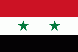
Country - United_Arab_Republic
 |
 |
| Flag of Egypt | |
The republic was led by Egyptian President Gamal Abdel Nasser. The UAR was a member of the United Arab States, a loose confederation with the Mutawakkilite Kingdom of Yemen, which was dissolved in 1961.
Currency / Language
| ISO | Currency | Symbol | Significant figures |
|---|---|---|---|
| EGP | Egyptian pound | £ or جم | 2 |
| ISO | Language |
|---|---|
| AR | Arabic language |
| EN | English language |
| FR | French language |