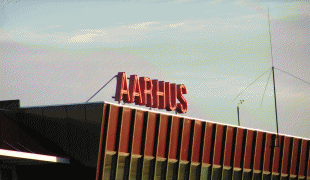
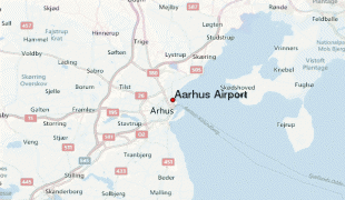
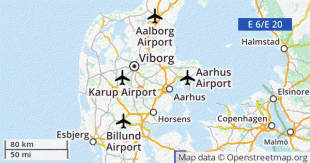
Aarhus Airport (Aarhus Airport)
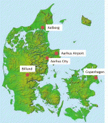
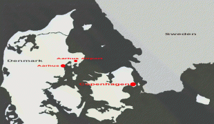
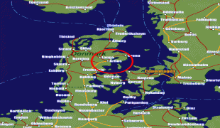
Aarhus Airport is a civilian airport located 19.4 NM northeast of Aarhus, Denmark.
The airfield was established in 1943 by German occupying forces in World War II and was later used as a Cold War military base for the Danish and other allied airforces until the 1990s. The airport still contains a small military depot and plays host to occasional training exercises; the last NATO exercise was in 2007.
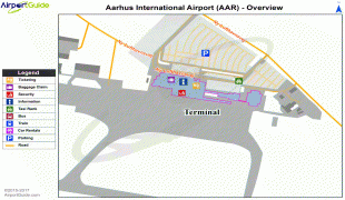
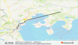
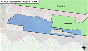
The current passenger terminal dates from 1981 with renovations performed between 2007 and 2009 and again in late 2016. Since 1946 the airport has carried civilian traffic and is the primary gateway for Aarhus, located 40 km from the city centre via the Djursland motorway. Since December 2016 the local authority of Aarhus Kommune is the major shareholder in the airport
The airport carried 500,490 passengers in 2019.
In March 2021, a construction project was announced. The project is scheduled to be completed in 2022. It includes a new hotel and increases terminal floor area from 5000 m2 to 10000 m2. Three new gates will be built so the airport has seven in total.
The airfield was established in 1943 by German occupying forces in World War II and was later used as a Cold War military base for the Danish and other allied airforces until the 1990s. The airport still contains a small military depot and plays host to occasional training exercises; the last NATO exercise was in 2007.
The current passenger terminal dates from 1981 with renovations performed between 2007 and 2009 and again in late 2016. Since 1946 the airport has carried civilian traffic and is the primary gateway for Aarhus, located 40 km from the city centre via the Djursland motorway. Since December 2016 the local authority of Aarhus Kommune is the major shareholder in the airport
The airport carried 500,490 passengers in 2019.
In March 2021, a construction project was announced. The project is scheduled to be completed in 2022. It includes a new hotel and increases terminal floor area from 5000 m2 to 10000 m2. Three new gates will be built so the airport has seven in total.
| IATA Code | AAR | ICAO Code | EKAH | FAA Code | |
|---|---|---|---|---|---|
| Telephone | Fax | ||||
| Home page |
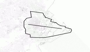
Map - Aarhus Airport (Aarhus Airport)
Map


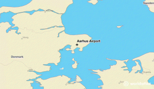

Country - Denmark
 |
 |
| Flag of Denmark | |
As of 2013, the Kingdom of Denmark, including the Faroe Islands and Greenland, has a total of 1,419 islands above 100 m2; 443 of which have been named and of which 78 are inhabited. Spanning a total area of 42943 km2, metropolitan Denmark consists of the northern part of the Jutland peninsula and an archipelago of 406 islands. Of these, the most populated island is Zealand, on which the capital Copenhagen is situated, followed by Funen, the North Jutlandic Island, and Amager. Denmark's geography is characterised by flat, arable land, sandy coasts, low elevation, and a temperate climate. As of 2022, it had a population of 5.928 million (1 October 2022), of which 800,000 live in the capital and largest city, Copenhagen. Denmark exercises hegemonic influence in the Danish Realm, devolving powers to handle internal affairs. Home rule was established in the Faroe Islands in 1948 and in Greenland in 1979; the latter obtained further autonomy in 2009.
Currency / Language
| ISO | Currency | Symbol | Significant figures |
|---|---|---|---|
| DKK | Danish krone | kr | 2 |
| ISO | Language |
|---|---|
| DA | Danish language |
| EN | English language |
| FO | Faroese language |
| DE | German language |