Tarrafal de São Nicolau (Concelho do Tarrafal de São Nicolau)
* Baixo Roche
* Berril
* Cabeçalinho
* Cachaco
* Carvoeiro
* Covada (Kap Verde)
* Hortelão
* Jalunga
* Praia Branca
Karte (Kartografie) - Tarrafal de São Nicolau (Concelho do Tarrafal de São Nicolau)
Karte (Kartografie)


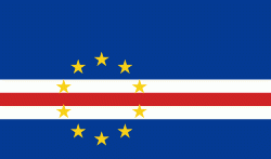
Land (Geographie) - Kap Verde
 |
 |
Die ehemalige portugiesische Kolonie zählt heute zu den stabilsten und wohlhabendsten Ländern Afrikas.
Währung / Sprache
| ISO | Währung | Symbol | Signifikante Stellen |
|---|---|---|---|
| CVE | Kap-Verde-Escudo (Cape Verde escudo) | Esc or $ | 2 |
| ISO | Sprache |
|---|---|
| PT | Portugiesische Sprache (Portuguese language) |